Exploring for the Future's Fuel
Southwestern Athabasca Basin | 33,507 ha | Includes both 100% Stallion Uranium and Atha Energy JV Claims.
Overview
The Upper Mirror River Uranium Project is a premier exploration initiative located in the uranium-rich southwestern Athabasca Basin. Covering approximately 33,507 hectares, it includes both 100%-owned claims by Stallion Uranium and joint venture claims with Atha Energy. The project is strategically positioned in a region known for some of the world's most significant uranium discoveries.
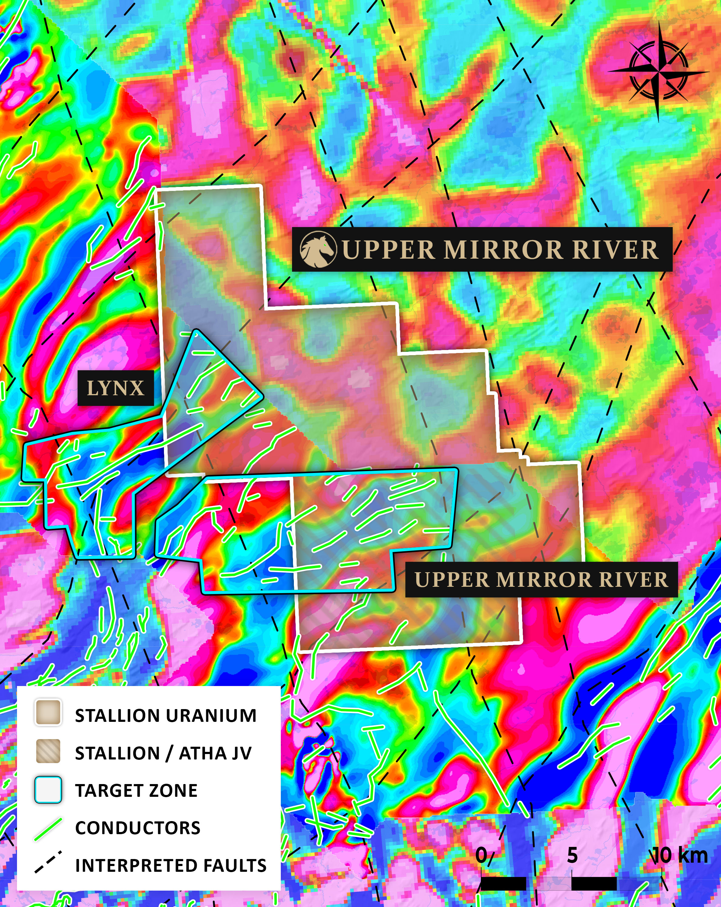
Stallion Uranium has utilized advanced geophysical techniques, including a MobileMT survey to systematically evaluate the property. These surveys have identified the Upper Mirror River Target and the northern extension of the Lynx Target, which are now advancing toward drill testing. The exploration strategy is focused on identifying basement-hosted and unconformity-hosted uranium deposits.
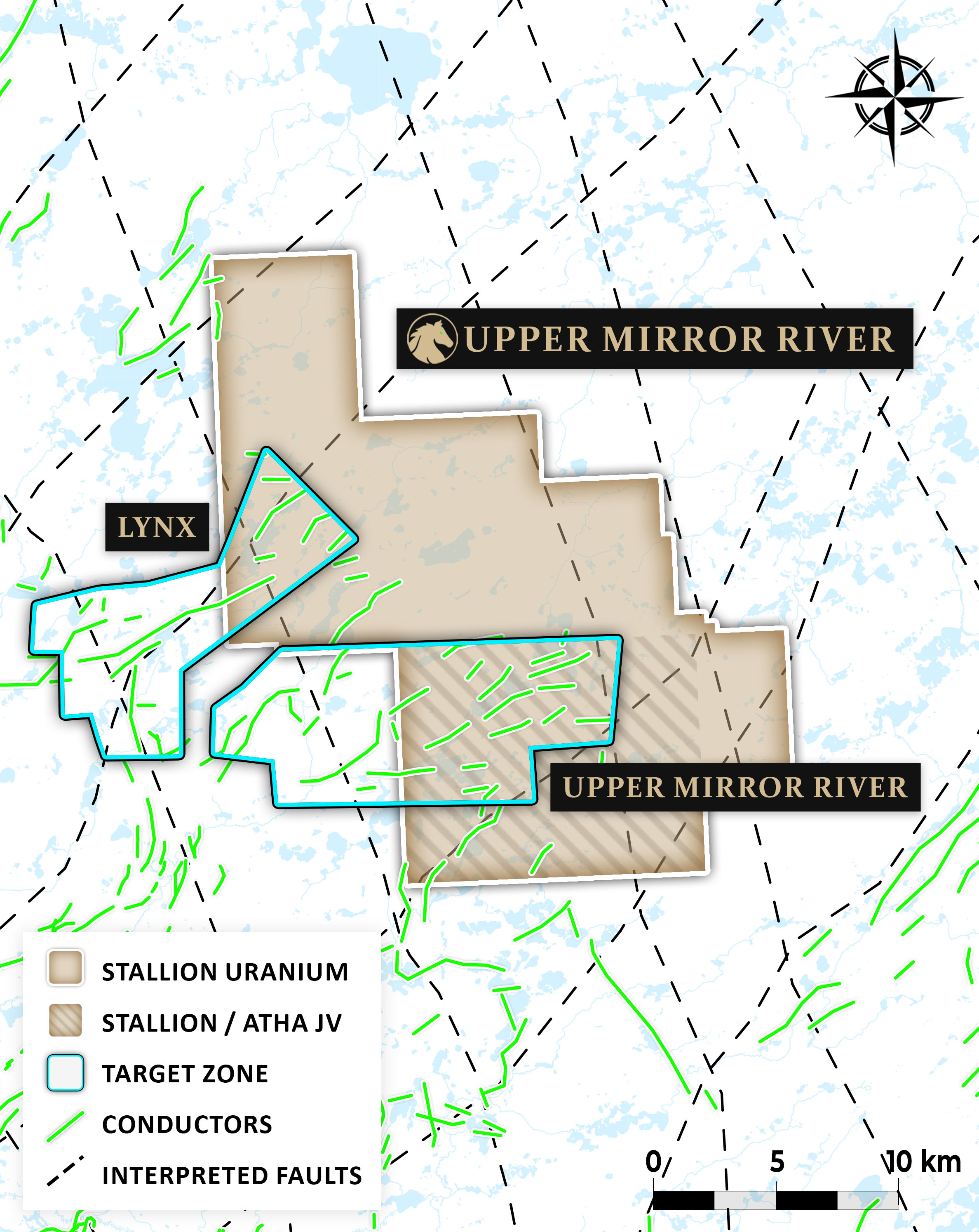
Figure 1 - Upper Mirror River Uranium Project
Exploration Targets
Upper Mirror River Target
The Upper Mirror River Target is a 17 km long conductive trend hosted within a regional magnetic low, a key geological setting for uranium mineralization. Remarkably, this trend remains entirely untested by drilling, highlighting its potential for a new discovery.
While a previous MobileMT survey confirmed strong conductive responses, it did not cover the full extent of the target area — meaning the true strike length remains open, representing a major exploration opportunity.
Our geophysical interpretation suggests the presence of multiple parallel conductors, potentially forming a broad structural corridor. This configuration is similar to the Patterson Lake Trend, host to world-class deposits like Triple R and Arrow. With its scale, structure, and untested status, Upper Mirror River is a top priority in Stallion Uranium’s exploration pipeline.
Exploration Roadmap
- Completed the remainer of the project with AFMAG survey.
- Reprioritize any new targets that are identified
- Advance exploration on those targets with Ground EM and gravity survey to identify drill targets.